Posts Tagged disto
Field BIM Kit : PKNail Pro : That’s my bag baby.
Posted by Jim Foster in BIM, Built Environment, New Technologies on May 21, 2012
The more demos I go on, the more I get asked about our field kit, so I wanted to post what’s in my bag and what we use on a day to day basis when surveying/modeling in the field with PKNail Pro. Those of you not interested in the day-in day-out particulars of surveying buildings may want to hit your back button now… Anyway an individual equally equipped will be ready for knocking out BIM Building Surveys, and this kit, all in, costs a fraction of most other technology solutions, plus the added benefit of surveying/modeling directly in the platform you or your clients are most likely working in. However, always choose the tool/service that fits your needs. In fact, we’ll be posting shortly where we combined workflows of PKNail Pro and pointclouds. But here you go, what’s in my bag or my complete kit.
- Tablet PC running appropriate software (PKNail Pro and Autodesk Revit)
- Disto D8
- Measuring Tape
- Sticky Notes
- Painters Tape
- Reflective Target
- Tripod
- Leica Tripod Attachment
- Laptop Tripod / Cart
- LED Flashlight / Wearable
- Diameter Tape
- External Laptop Battery
- Rechargeable Batteries
- Laptop Bag
- Food
- Building Chalk / Marking Crayon
So it might seem like a lot but all fits in the bag except for the tripods. The laptop tripod is excellent when mobility/portability with your gear is at a premium but I will use a laptop cart with wheels if the space allows; it is easier with wheels and has more surface area to put stuff.
The real minimum you need to have with you is a laptop/tablet PC running the appropriate software, a Disto D8 or 330i, a measuring tape, and something to use for a target when needed, like an outside corner. Stickynotes (larger size) are excellent for shorter distances, a reflective Leica Target attached with Painter’s Tape is better for longer ones. Rechargeable batteries for both the laptop and Disto. I prefer an external battery pack for the laptop as it can be used on any laptop and it is self contained unlike an extra battery for a specific laptop.
I like Eneloop rechargeables for devices, my preference, they come preloaded with a charge, and seem to carry it longer when not being used. You need a measuring tape on occasion for distances to short or sometimes nice to hook something with a tape when finding a distance manually. I like thick banded measuring tapes because they will extend longer without ‘breaking’ but find they are just as prone to wear down as any other so sometimes not worth the expense. LED flashlight because they are bright and do not use as much juice as others, and are always nice to have. I also have an LED light that you can wear on your head, which is my preferred. Diameter tape is a luxury but one side is graduated the other will measure the diameter of any round column which is helpful.
The tripod attachment from Leica allows it to pivot properly on the its axis so the measurements stay as accurate as possible. This is great to have for exterior work when you might not have access to the interior of the building. Building chalk or a marking crayon can be helpful but usually would want to mark with painters tape or sticky pad because they are easily removed, however, the former comes in handy sometimes, especially in basements.
And bring food and drink, nothing clouds your mind like being hungry, so eat.
Reality Capture #2 on Autodesk Labs Hit List : Project Galileo to join other tools. BIM
Posted by Jim Foster in 3D, Autodesk, BIM, Built Environment, Point to Point Laser Technology, Revit on November 30, 2010
 As reported by Matt Ball, Brian Mathews, the Autodesk VP in charge of Autodesk Labs, gave a media briefing updating ‘his Seven Technology Trends lecture with example projects.’ Reality capture or as otherwise stated, turning analog into digital, being #2 on the hit list. So capturing the Built Environment is starting to get serious traction, and while I hesitate to use the word traction, well, that’s what its getting.
Previously in the conversation people would talk about all the wonderful things software can do for buildings, then you realize the majority of construction is in the built environment and it becomes, well just give me the building, or at lest the digital equivalent of the building and look at the wonderful things software can do, however, most presupposed the digital equivalent of the building. Not anymore, more and more companies are releasing software and tools to capture the built environment, or call it reality capture if you like, but soon there are going to be a lot more tools on your shelf.
Autodesk has released, Project Photofly . and will soon release Project Galileo which according to its splash page, “is an easy-to-use planning tool for creating 3D city models from civil, geospatial and building data, and 3D models.” Plus Autodesk has release shape extraction tools from PointClouds directly inside of AutoCAD. Rand Technology/Avatech/Imaginit hybrid has released PointCloud manipulation tools inside of Revit and we are in the final beta of PKNail, a PPLT (Point to Point Laser Technology) system that allows a user to drive Revit commands and enter dimensional data directly from a range finder allowing a user to build a Revit model in the field. Plus we recently saw the beautiful kinect hack allowing a user to capture and even measure 3D video. I can’t say which technology or mixture of technologies will work best for you, but your job is going to get easier.
Laser to Revit : Laser to BIM : New Tools to Capture the Built Environment
Posted by Jim Foster in BIM, Built Environment, disto, Laser BIM, Revit on November 13, 2010
 With PointKnown’s introduction of PKNail and PPLT (Point to Point Laser Technology) utilizing a Leica Disto and Rand Technologies recent press release announcing the ability to manipulate and manage laser scan, point cloud data within Revit the opportunity and tools to capture existing conditions continues to grow. Combine that with the growing need to capture existing conditions for energy modeling and retrofits and you can see an industry emerging, not just using it for special circumstances but start capturing existing structures in 3D/BIM for uses that range from space planning, facility management, energy audits and beyond.
While it has been reported and analyzed that some of the biggest frustrations, time sinks and expenditures is that lack of interoperability between software, and redundant efforts between disciplines, that is creating the same thing, many times for each discipline the advent of BIM authoring tools like Revit, and ways to combine and work with them can help firms and individuals reduce rework and create more opportunities for their design and construction work; looks like a win all around. And with these technologies firms can start on existing structures in BIM and Revit and have all the benefits.
PointKnown Nails It. Rapid Models Autodesk AEC HQ in Waltham: Pilot moves on.
Posted by Jim Foster in 3D, BIM, New Technologies on November 4, 2010
 So some individuals at Autodesk got to see our ‘handcrafted’ videos available at our PKLabs YouTube Channel and got in touch. Ani Deodhar, a Program Manager in their Sustainability Group, explained to me he had a mandate to come up with the best work flows across all of their product lines in order to energy model existing buildings. They have been working on geometry extraction in the labs and anyone who has seen the Photofly demos can attest, this looks very promising. However, our goal with PKNail was always to capture dimensionally correct space and do so with a minimum of software knowledge so PKNail can be leveraged across an organization rather than with a specialized few. I am not knocking any process just pointing out that if you want to move a pallet, for example, it would be nice you could just do it rather than find the guy or gal with the forklift license and then ask them to move it, and then hopefully you get it right the first time. Maybe not the best metaphor but you get it, the more people that can do something, the more of whatever ‘it’ is you can do.
 On site at Autodesk Waltham and using PKNail we were able to survey, measure, build in real time the shell of the building in Revit in less than 3 hours. Then depending on what level of detail, and features you want in the deliverable you may want to spend sometime in the office. However, when we left we knew we had all the key dimensions and information and the model itself was built. This was done at a level needed for energy modeling and we only modeled from the exterior but PKNail allows you to create interior layouts, floor by floor as needed as well. It was then ported through Revit CEA to create an energy analysis of the building.
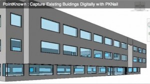
When creating PKNail we wanted to make things easier on ourselves. The product grew organically from our architectural surveying business. When you’ve repeated the same task enough times, or if you missed a crucial step or measurement that would require you to back to the field, etc. you think there must be a better way. Just like when you make the jump from 2D to 3D you thought, there must be a better way to communicate with my clients, coordinate views, coordinate disciplines, and here it is. Revit is increasingly becoming that better way. Use it however you want, it’s a tool, you can use it communicate visually with your clients if that’s what you need it for or use it to coordinate construction; your choice but it helps. PKNail allows you to quickly and accurately capture existing buildings digitally, either just the exterior for energy modeling or to start your as-built documentation.
On a recent conference call to discuss our pilot with Autodesk, one of the attendees said something like this:
“So you simplified the GUI to automate the tasks you need when surveying and allowed for the wireless capture of data to minimize key stroking”
Well, I don’t know if I would say it exactly like that, but yeah, that’s what we did, and I added that we created a workflow and process that squeezes the surveying knowledge of our organization into the software so people can be a success right out of the box. We wanted to take something simple, point and shoot distance meters, very simple and marry it with something that can be infinitely complex, 3D BIM authoring tools as in Revit, and in turn try to make that simple. Measure a wall/build a wall, window, levels, etc. We call this PPLT (Point to Point Laser Technology). So until we got robots doing this stuff we can never take away the human element from what we do, and so, let’s make just make it easier, faster, better, much like the $6 million dollar man.
Survey Angled Walls in Revit with a Disto and PKNail
Posted by Jim Foster in Point to Point Laser Technology, Revit on August 4, 2010
One of the tougher issues and part of any surveyors work flow is to capture non-orthogonal (i.e. angled) geometry correctly the first time. This increases in importance if the angles are played throughout the building and especially if they are part of the exterior. In order to help users capture a building’s geometry in Revit while in the field PointKnown has incorporated triangulation and a close room function as part of our PKNail Building Surveying Software. Having the Disto drive Revit allows quicker data capture and increased accuracy. And while many of us might want to be watching videos of the beach in August I still included the process here as well.


 So if you wonder if this social media stuff works, if blogging is worth it, well my recent post on the Leica 3D Disto wound up on the Leica shore and John Anderson from Leica GeoSytems was kind enough to answer some of the questions I posed. So those of you who were sitting on the edge of your seat. Here ya go.