Posts Tagged Point to Point Laser Technology
Pointknown Wraps Up 18 Tremont : Building Surveying & Documentation : Direct to Revit
Posted by Jim Foster in BIM, Built Environment, Revit on February 8, 2016
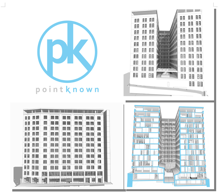
We recently delivered a Revit EB (Existing Building) Model of 18 Tremont a historic 12-story, 202,000-square-foot office with ground-floor retail in downtown Boston. The building was acquired by DLJ Real Estate Capital Partners in October 2015. Pointknown, with its partners, created an exterior HDLS (High Definition Laser Scan) and Revit model of the exterior as well as the elevator lobby, and stair cores. After creating the base Revit model the Pointknown Team utilized PKNail Pro , a point to point, direct to Revit, reality capture tool, to document interior wall partitioning, doors, and bathroom layouts. Using the combined technologies helped us tremendously in speed and accuracy, and the database functionality of Revit allowed us to assign spaces/offices and run space calculations a lot easier than polylining spaces. We were then able to produce formatted documents, floor plans, sections, space calculations for the owners / investors and delivered the model for the designers.

Google X : Project Genie : Vannevar Technology -> Wants to Change AEC, Change the World
Posted by Jim Foster in BIM, New Technologies on November 4, 2013
 There seems to be little known about what’s going on at this century’s Xerox PARC, Google X and it’s Project Genie, but a small amount of information was unveiled at ArchDaily. Google’s commitment to sustainability is apparently going to reach into the AEC industry and possibly trample into Autodesk’s campsite. While other software firms are hampered by their own internal growth and sales and what they can commit to marketing, (Autodesk wins there) and R & D. The folks at google, know no such bounds. The spinoff Vannevar Technology (which sounds suspiciously close to Vandelay Industries,) is working on creating…..who knows. Their website states “Reimagining building design for a more sustainable future.” Which is about as exciting as the 5th slide in a time share deck. However, google has the clout and cash in what can be a very stubborn, hesitant to change,” what are you talking to me ” culture. Typically the principals in architecture firms don’t care about technology, they have minions to get it done so why invest in software or new tech when my current pricing, business structure, ROI formulas are working and set in stone, plus I don’t like business that much I like designing building so the less I get involved the better. Engineers will analyze and without comparable metrics to analyze, then…paralyze. Construction managers will embrace tech if it saves the time, which equals money, so time and money but they have to live with the consequences, so embracing new tech….tough crowd. Which is far from saying that things can’t be done better.
The small bit of copy on the web site rightly touts that buildings, yes buildings produce the most greenhouse gases, 40%, so what is google going to do about it? Systems, software, construction methods, materials, vertically integrate and go borg on the industry. My guess is whatever they do, they will be building some buildings with Vannevar Tech for proof of concept and case studies. My guess it’s got be some integrated design and FM system to produce tangible CO2 / greenhouse gas savings, plus energy savings. Some have guessed it might be a SketchUp on steroids, but then why did they sell it to Trimble. And who cares about the design process, what part of that is the current lifecycle of a building, very little, I’d want to own the building for most its life, it’s operating life, and want to own the management of it, and the data. There ya go, so then, IBM and Maixmo, meet google, you might know them. These are the crazy kids floating balloons for internet access. 
Adopting New Technologies and Business Practices : When’s a good time?
Posted by Jim Foster in Adoption, BIM, New Technologies on December 21, 2012
 Is there ever a good time to adopt a new technology or business practice? No. Yes. Today. First, ask yourself these questions, “Will it make me or our organization more profitable? Will it lead to new business opportunities?” One broad way to measure profitability is ROI in the investment. How much will it cost to introduce a new technology or business practice, what costs are involved, how quick is the pay back. Are there metrics in place to measure this? One can argue during downtime or between large projects is the best time to invest so they can be incorporated from the beginning of the next project. Cost center issues get caught up with the CFO or whatever other gate keeper that is out there because they cannot be assigned or passed on to a client. Why is this an argument? It might not be said out right, but this type of accounting is just easier and no one ever gets in trouble going with the flow. You were not the one who approved such expenditures so it can be pinned on you. Be an evangelist. Things need to get done. If there is a better way to do it. Do it. You know eventually your competition is going to and will either be A) more profitable B) more efficient or both and start making money at a lower cost than you are. You’re an artist, and it’s always worked this way. Okay, maybe, but that doesn’t scale. The organization is you. And maybe that’s okay but I don’t know how you hire and keep talented people. People like to solve problems and they want the tools to solve them. You have to build a house. Tough to argue for the hammer over the nail gun.
One business proverb always comes to mind when dwelling on this issue.
“If you don’t like new technology you’ll like obsolescence even less.”
Next Time: “It’s all Organization Behavior”
RMI to Host Summit for Energy Modeling : BIM
Posted by Jim Foster in BIM, Energy Modeling, Professional Building Surveyors on February 9, 2011
 “Reliable and consistent building energy modeling services are key to maximizing energy efficiency and achieving aggressive performance goals in new and existing building construction. Currently, how ever, various barriers inhibit the cost-effective and high-quality analysis that can result in deep energy savings.”
You would have thought I wrote that myself, but I did not, thank Molly Miller from the Rocky Mountain Institute. To learn more about the summit visit the RMI Website . But things are starting to dovetail for building surveyors and energy modeling further enforcing the need for a trusted source when documenting existing buildings and analyzing them. Read the quote from Kendra Tupper, Senior Consultant at RMI.
“There is a lack of confidence in the quality, consistency, and reproducibility of energy modeling results. Coupled with the fact that it’s time-consuming and expensive to conduct quality analyses, it’s difficult for practitioners to effectively use energy modeling to inform design and make compelling business cases for investing in energy efficiency.”
PBS, Professional Building Surveyors, pick up the phone.
Professional Building Surveying acclerating : Certificate Programs : Professional Stamp : BIM CAD BOOM
Posted by Jim Foster in Adoption, BIM, Existing Conditions on February 3, 2011
 So what is a Professional Building Surveyor? In Europe they have degreed programs in Building Surveying and the RICS (Royal Institute of Chartered Surveyors) charters professional surveyors. Here in the US, the intent is not to make it all encompassing but rather define it as capturing dimensionally correct space and deliver it in either a 2D CAD Format or BIM Authoring Tool. That is represent reality, digitally so other professions can have faith in the plans and models and build/design on those results. Simple premise and one that is long overdue.
Why overdue? A variety of reasons. Current workflows allow for almost every discipline to verify a building because no one has faith in the earlier results requiring a huge waste of manpower reproducing similar plans. There is a huge need for a trusted source in as-built/existing condition documentation. The majority of construction is done within the existing environment and all these project start with the same thing, documenting the building. That is a multi-trillion dollar industry with no standard in how to document an existing building. Sustainable retrofits have started to really pick up steam and the ability to quickly and accurately capture a building allows for rapid energy modeling and ROI analysis and retrofit options. Condo documentation? What’s needed? Accurate documentation. It goes on but I wanted to interrupt with an anecdote:
I was listening to the radio and a man was telling a story about how we went back to school to train in CAD, I believe he said he stamped metal in Detroit for GM before being laid off, he picked CAD because he thought it was 21st Century profession only to find that a lot of the CAD jobs were going to places like India, the Czech Republic, etc. leaving him more than frustrated. Professional Building Surveying, because of the nature of the work, it is work that cannot be outsourced. Regardless of your view on globalization it’s nice to develop a skill and profession that you know remains local.
Currently, we are at work on curriculum development for a certificate program and the certification requirements to receive a stamp. And its not something that gets to be taken lightly as its serious business. Thousands of hours of drafting/modeling/surveying experience is required to earn a stamp but to get entry into the profession you can start with the certificate program and regardless if you earn your stamp and I’ll need to quote the head of a virtual construction department when I asked her if she would need someone who had the knowledge of current building surveying skills, technologies and CAD/BIM platforms, her answer, ‘I need one tomorrow.’ It’s on.
Reality Capture #2 on Autodesk Labs Hit List : Project Galileo to join other tools. BIM
Posted by Jim Foster in 3D, Autodesk, BIM, Built Environment, Point to Point Laser Technology, Revit on November 30, 2010
 As reported by Matt Ball, Brian Mathews, the Autodesk VP in charge of Autodesk Labs, gave a media briefing updating ‘his Seven Technology Trends lecture with example projects.’ Reality capture or as otherwise stated, turning analog into digital, being #2 on the hit list. So capturing the Built Environment is starting to get serious traction, and while I hesitate to use the word traction, well, that’s what its getting.
Previously in the conversation people would talk about all the wonderful things software can do for buildings, then you realize the majority of construction is in the built environment and it becomes, well just give me the building, or at lest the digital equivalent of the building and look at the wonderful things software can do, however, most presupposed the digital equivalent of the building. Not anymore, more and more companies are releasing software and tools to capture the built environment, or call it reality capture if you like, but soon there are going to be a lot more tools on your shelf.
Autodesk has released, Project Photofly . and will soon release Project Galileo which according to its splash page, “is an easy-to-use planning tool for creating 3D city models from civil, geospatial and building data, and 3D models.” Plus Autodesk has release shape extraction tools from PointClouds directly inside of AutoCAD. Rand Technology/Avatech/Imaginit hybrid has released PointCloud manipulation tools inside of Revit and we are in the final beta of PKNail, a PPLT (Point to Point Laser Technology) system that allows a user to drive Revit commands and enter dimensional data directly from a range finder allowing a user to build a Revit model in the field. Plus we recently saw the beautiful kinect hack allowing a user to capture and even measure 3D video. I can’t say which technology or mixture of technologies will work best for you, but your job is going to get easier.
Survey Angled Walls in Revit with a Disto and PKNail
Posted by Jim Foster in Point to Point Laser Technology, Revit on August 4, 2010
One of the tougher issues and part of any surveyors work flow is to capture non-orthogonal (i.e. angled) geometry correctly the first time. This increases in importance if the angles are played throughout the building and especially if they are part of the exterior. In order to help users capture a building’s geometry in Revit while in the field PointKnown has incorporated triangulation and a close room function as part of our PKNail Building Surveying Software. Having the Disto drive Revit allows quicker data capture and increased accuracy. And while many of us might want to be watching videos of the beach in August I still included the process here as well.
Revit As Built : Field BIM : Existing Conditions
Posted by Jim Foster in BIM, New Technologies, Revit, Uncategorized on June 29, 2010
While I don’t usually take the time to pump my own gas with this blog I wanted to share the complete reversal in our deliverables over the last year. It used to be, way back at the end of 2008 that we delivered most of our building surveys in 2D AutoCAD format, now we would build in 3D, normally in ADT but our clients wanted 2D AutoCAD. From a surveying perspective a 3D object oriented universe worked better for us because essentially all the views were coordinated, that is build it in the floorplan directly, it is represented in elevation correctly. Anyone who has keyed up a plan in 2D knows where I am coming from, which if you are here reading this, means you know what I am talking about. Now, however, the bulk of what we do is deliver as-builts in Revit. The GSA requiring BIM has a lot to do with it, I believe, and Autodesk being the biggest player in the US means Revit becomes the default. Whether you like that or not does not matter, that’s the reality.
 Recently we have performed as built surveys at Phillips Exeter and Emmanuel College and we were field testing our laser to BIM technology, PKNail. It was created to capture typical conditions quickly and accurately. If you wanted to capture the Capitol Dome, I would suggest laser scanning, for capturing most situations Point to Point Laser Scanning (PPLT) should work just fine. PKNail converts measurements directly into a Revit workstation-wirelessly, measure a wall that wall is entered into Revit, encounter a door, window, Fire Extinguisher Cabinet, sink, if you can measure it, it can be placed quickly and easily into the model.
Lastly, if the deliverable is 2D CAD, exporting views from Revit to AutoCAD sheets is a snap. Here’s a long winded Autodesk treatise on the subject or well, it looks like I will need to update with a screen capture video the quick process but the resulting CAD contains some of the meta information collected in 3D, such as 30″ Door, rather than creating anonymous objects. Next post will follow in short order with a sneak peak of some of the features and the connectivity between Revit and a Leica Disto enabled by PointKnown surveying software.
Thanks for tolerating some self promotion.
Public Beta Open in January : Capture as builts in Revit in the field: #Revit #BIM #asbuilt #laser #pplt
Posted by Jim Foster in As Builts, BIM, Built Environment, Existing Conditions, Laser BIM, Laser Scanning on December 16, 2009
We will be opening up our beta to public testing in January and we are asking for volunteers. Our product PKNail allows a user to use a hand held laser, Disto D8, and measure and build Revit models in the field. The measurements are transmitted via bluetooth to a mobile workstation which allows the user to quickly and accurately captures a building geometry and features. On board intelligence allows users to determine wall thicknesses, wall angles, toggle accuracy, attach notes to objects and more.
PKNail was developed by field surveyors and software engineers to help the AEC Community quickly and accurately capture a building’s geometry in Revit. This tool used alone of in conjunction with HDLS (High Definition Laser Scanning) can let you start any project in BIM / Revit. Proven ROI in as little as one project, and speed gains from measuring to model of over 200%.
With the majority of construction projects happening in the built environment, and in cities like Boston almost 80% done in the built environment start them in BIM and help everyone downstream.
This a powerful tool in capturing as builts in Revit and beta testers will be eligible for a substantial discount when purchasing.
info@pointknown.com
BIM As Built : Laser Technology
Posted by Jim Foster in As Builts, BIM, Laser Scanning, New Technologies, Revit on December 1, 2009
Speaking to a colleague from Europe who moved to the US because he stated, ‘there’s a survey shop on every corner in the UK, I could only find a handful here.’ However, that’s changing. HDLS, high definition laser scanning is starting to take off, especially now that the GSA issued the laser scanning awards. Additionally, more and more people are reworking existing assets / adaptive reuse projects so it is becoming more and more important to get the existing conditions data. While everyone is waiting for the day we can walk around with a magic wand and wave it around the room we have to build a bridge from here to there. HDLS in creating a 3D database is an excellent start. I believe HDLS, from firms like Leica and FARO, performs fantastically in certain circumstances such as inaccessible or difficult geometry, exposed MEP intensive projects, however, for typical conditions especially the interior of buildings it might be akin to using a sledgehammer rather when you need a fly swatter. We, PointKnown, have been developing a product that bolts on to Revit and takes laser range finder data and builds objects as you measure. This has been defined as PPLT (Point to Point Laser Technology). It allows a surveyor to move quickly and accurately from room to room or object to object. We do not intend for it to usurp laser scanning but rather augment current surveying teams, allowing them the most flexibility depending on the situation.
Most importantly is to define the deliverable and type of model needed for the project. This can start at the basic architectural model using generic library items to, well , anything goes but most of our clients want dimensionally correct space and then they apply the material and details they need as that is what they want to control.
We are now accepting people and firms into our public beta that starts January 2010, if you have any interest please feel free to contact us at info@pointknown.com and put beta in the subject line.
